
Touring Norway
We decided this year that it was about time we went back to do another tour in Norway. I had come across the Mjølkevegen route whilst having another look at the www.cyclingnorway.no site. For some reason, the Mjølkevegen isn’t on the English-translated part of the site you will find it under ‘Ruter’ on the Norwegian part. Mjølkevegen translates in English as the Milk road and as its name suggests was the road that connects all the high pastures of the largest and most active mountain farm areas of Valdres, Stølsvidda.
The high-altitude gravel road which climbs up to the high plateaus that are over 1000m in altitude is used to collect the milk and take it down to the valleys. In the olden days, the milk was transported in milk churns and each little set of farmsteads had a milk-churn stand by the side of the road with the name of the farmsteads. Luckily many of them remain and make an attractive sight along the route.
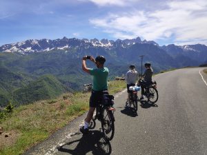
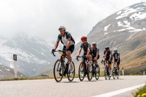
 Most of the Mjølkevegen is on gravel roads with some short sections on proper tarmac roads. The gravel sections on the Peer Gynt vegen and the Jotunheimvegen are a toll road for cars and there is very little traffic. The route is actually classified as a mountain biking route but it perfectly feasible to do on touring bikes however you have to be prepared for some tough climbing but once you get up on the plateaus the scenery is some of the best in Norway.
Particularly the sections on the Jotunheimvegen along the Vinstre lake and the climb up the Slettesfjell were spectacular and will be well remembered for years to come, not only was the scenery good but the flora is rich with some wonderful wildflowers.
On reaching Gol for our route back to Oslo we decided from the advice of our friends Stan & Daema to use the Numedalsruta down to Kongsberg and then get a train to Oslo rather than tackle the very busy Fv7. Apart from the long climb up Rukkedalen most of the route was downhill which made a very pleasant change to all the climbing we did on the Mjølkevegen.
Home to Oslo
We left home in good time but there was an accident on the B1066 which blocked the road so we had to turn around and go via Garboldisham. Fortunately, it hadn’t made us too late and we were still in good time to park our car at my sister’s house and cycle the mile and a half to the airport. Our flight out from Norwich to Amsterdam was on a Fokker 70 and it was good weather so we had some good views as we came into land at Schiphol. It was a short transfer from the Norwich flight at Schiphol to get the Oslo flight so we had to hurry around the airport. The Oslo flight was again on another Fokker 70, it was just a shame that we couldn’t have got a direct flight.
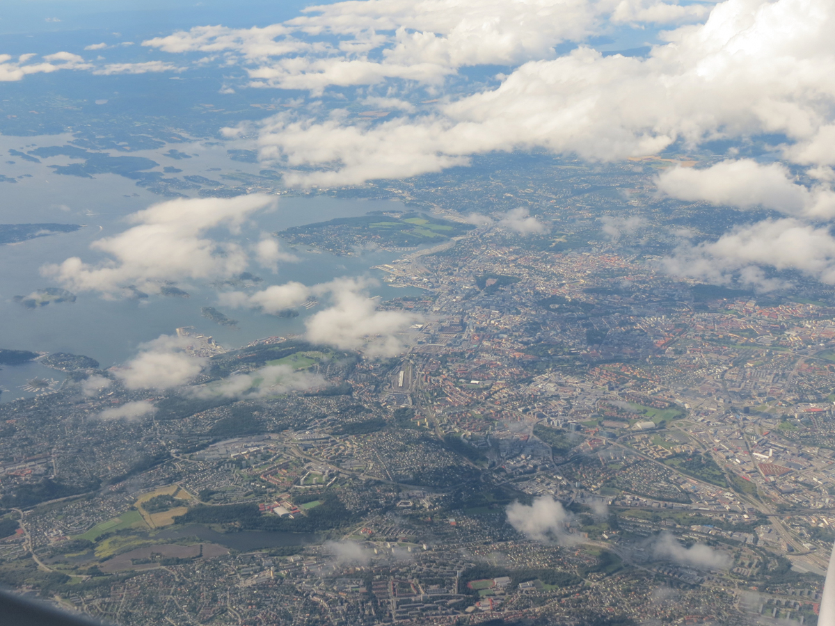
On getting to the Norwegian coast there was a little bit of cloud but generally good views out of the plane window. On landing, at Gardermoen, it didn’t take long to get our luggage and the bikes and we put the bikes together in the airport concourse after we had left customs, they seemed to have survived the flight without any problems. It was only a short ride along the pathway to the Raddison hotel. They let us put our bikes in their left luggage room. That evening we had a lovely meal in their restaurant. It was their summer buffet and the best bit was the salmon and fish soup.

Oslo to Kvam
Having left our bike bags with the hotel to pick up on our return we headed off to the station at Gardermoen. We intended to catch the 9.59 am train from the airport to Vinstra. When we bought our tickets the young lad said that the train would leave from platform 4. But when we got there using the lift the information board said that it was leaving from platform 1 so we rushed back to the lift and over to platform 1. We need not have rushed as the information board on that platform said that the train was delayed by 20 minutes.
The information board very helpfully told you which carriage took bikes and when the train finally arrived it was easy to walk the bikes onto the train, much easier than getting on to most UK trains. We had to change trains at Lillehammer and we knew that we only had 20 minutes to change trains there however when we were approaching Lillehammer we had made up 10 minutes of our delay. The Vinstra train was just across the platform which made it easy to get the bikes across. As we approached Tetten there was a little drizzle however when we got off at Vinstra it was dry but overcast.
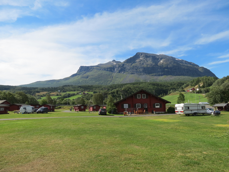
We were in need of a drink so we popped into a bakery which had its own cafe and we had a very welcome coffee and wiener brot. After our refreshments, we cycled down the town to a small out-of-town shopping mall where there was a GSport where we bought some camping gas and visited a Mega CO-OP for some food. We had planned on staying at the Bøygden campsite at Vinstra but we were told that it had shut so we headed up to one at Kvam 10 km north of Vinstra. Rather than cycling the busy E6 we took the 417 on the west side of the river.
On the way, we found our first Norwegian cache at the Sødorp Kirke just over the footbridge as we left Vinstra. Soon after leaving Vinstra, it started to rain and we put on waterproofs. Although there was an initial hill coming out of Vinstra it was a lovely ride alongside the river and we were soon turning over the bridge to Kvam. They were putting in a bypass for Kvam and the tunnel entrance was near the bridge and they were constructing a new bridge close to the one we were crossing. As we turned on to the E6 it was quite busy with traffic and we could see why they needed a bypass.
We soon found the left turn to the campsite but had a bit of a shock as the sign said that it was another 12km to the campsite. I thought this couldn’t be right and we turned down to where the map was showing the campsite and soon saw the campsite which was a relief, the sign must have been signposting for campsites further on.

Kvam
As things had been rather hectic since the end of term we had promised ourselves to slow the pace down and have a rest day. We didn’t miss much as it rained most of the day.

Kvam
Frank and I were still fairly tired so we decided to take it easy and take the time to visit the Krigsminnesamling in Kvam which was very interesting as we hadn’t realised that there had been a battle here in WWII where our brave boys mainly from the King’s Own Yorkshire Light Infantry and the Green Howards fought a rearguard action to try and slow the German advance into Norway in 1940. Afterward, we went to the Kirk across the road where 52 of our brave boys lie in a commonwealth war grave. The Kirk itself was burnt down in the fighting and was rebuilt in 1952. In the afternoon I went out for a short ride down the valley to find a couple of caches.

Kvam to Fefor
With our rest days over it was time to get going and hit the Mølkevegen. We set off at 10.30 am and we headed back along the 417 the way we had come along from Vinstra the other day. It was a beautiful sunny morning and there were loads of lovely wildflowers along the road for Frank to photograph. We got to Vinstra just after 1 o’clock and stopped for lunch in a cafe in a small retail centre before setting off again. The first part on the 256 was easy enough but it was when we turned up on the 422 that it got interesting.
Up was the operative word! It really was hard going especially as we were in full sun most of the way and we were dripping with sweat. After doing the first few kilometres of what must have been a 15% gradient we were seriously considering whether we were up to doing this route. It didn’t help that we knew we weren’t at our fittest but we just pushed on and had to just resign ourselves to the fact that it was going to take a long time. We literally climbed a few hundred yards and then had to stop to get our breath back.
There seemed to be quite a bit of traffic going up the road and we worked it out afterward that it was due to the theatre production of “Peer Gynt” that was taking place by lake Gålåvatnet. When we got to the Vollsdamen lake we did consider camping there but there were a lot of people enjoying the late afternoon by the lake so we headed on which was just as well as there were another 150m of climbing to get to Fefor and we didn’t fancy doing that first thing in the morning.
As we got to where the turning for the Fagerlivegen we were expecting according to our map that the road surface would change to gravel but it was still tarmac and the gradient didn’t ease up. There was a little rest bite as we got to Kronhjulsbakken and we stopped to get our breath back and admire the view we had certainly climbed a fair few metres in height (checking the elevation profile later we had climbed 1008m that day). It finally leveled out at around 950m.
We didn’t get to the Fefor Fjellhotell until 7 o’clock. The lady at reception looked a bit gone out when I asked if we could camp in the hotel grounds ‘but we don’t have a camping ground’. Don’t worry about it pet have you got a hytte free? Luckily they had it was a bit expensive at 1600kr but what the heck we were both so knackered we didn’t care. It was quite a nice hytte with its own toilet, shower, and kitchen.

Fefor to Hattdals
We were up and away fairly early as we had no tent to pack up. We nipped back to the Fjellhotell to hand in the key for the hytte. Fefor Fjellhotell has quite an interesting history as it was the hotel that had been used by Robert Falcon Scott whilst he was trying out his new motor sledges prior to his expedition to the South Pole in 1912. The initial test was for the sledges to get up the bumpy track from Vinstra which they did with ease pulling 100 local village folk to the delight of Kathleen Scott. Scott himself was a little less passionate saying “for 3 thousand pounds one would expect it to do something of use”.
They were later tested on the lake at Fefor but Scott was perhaps correct in being sceptical as they proved useless when they were used in the Antarctic. In the 1930s there was an airplane route from Oslo to Fefor to bring in winter holidaymakers to the hotel where the planes used to land on the frozen lake. During the second world war, the hotel was requisitioned by the Nazis. Whilst the German officers holidayed at the hotel right under the Wehrmacht’s noses the hotel owner set up a Milorg Brigade comprised of workers from the hotel and under the cover of darkness regularly picked up arms shipments that had been parachuted in from England.
After an initial short climb from the hotel to the Peer Gynt Vegen it was downhill most of the way through for the first few miles through birch scrub and fir trees on a gravel road. There were loads of wildflowers along the roadside and Frank couldn’t help but stop and take photographs. So our progress was a little slow at times but it didn’t matter as that is the reason why we do these trips to enjoy the fauna and the flora. As we descended through the forest we met several large tractors with huge trailers full of reels of hay. We eventually dropped through the trees and came to Lomsetrin a lovely lush plateau with hay meadows and small summer houses for the farmers. The farmers were cutting and bailing haymaking the most of the dry weather.
As we came around a bend we met two tourers coming in the opposite direction and stopped to have a quick chat. They were from Holland and were also doing the Mølkevegen. After the hay meadows, the route went back into birch scrub and we climbed steadily up to Hattdalen where it became more open moorland with some great views of Stølfjellet. We reached the highest point at 1000m just above the collection of summer farms at Hattdalssetrin and I spotted a nice grassy area just off the road.
Although it was only 3.45 pm we looked at the map and decided that there didn’t look like many other camping spots on the route ahead of us as we would be soon descending into Dalsetter. I had remembered that there had been a reasonable stream just a few hundred metres back the way we came so I unloaded the panniers from my bike and gave Frank the tent so that she could be putting the tent up whilst I went for the water.
As I was climbing back up from getting the water I could see Frank standing looking at me and no tent up! On getting closer Frank shouted ‘no pegs’. I had the pegs in the pannier that I had taken to put the water container in, oops! There was a lovely view from our wild camp across to the Jotunheim mountains and it was a lovely warm evening so for the first time in a long time, we sat outside and cooked our evening meal. There were a few mosquitoes about but there was just enough wind to keep them at bay.

Hattdals to Olstappen Lake
We had a reasonable night’s sleep and I cooked pancakes for breakfast which were made from a dehydrated mix, they weren’t too bad but not as good as a fresh pancake mix made with real egg and milk! It was nice to be going downhill from our campsite for a change.
Soon after Hatten not that far down the track, we spotted a cache on the GPS. As this cache wasn’t too far off from the track we parked up the bikes and headed off up the hill to find the cache. Initially, there was a good path that seemed to be taking us away from the cache but looking at the map it looked like the cache was on a small promontory and that the path probably took the easier ground along the spine of the hill rather than the steeper way especially as it was thick birch scrub. We continued on and the path got narrower, at this point, Frank stopped to take some photos of the wildflowers and suggested that I go on ahead and that she would catch me up. The path very soon disappeared but I climbed up and up checking the GPS as I went as the birch scrub was quite thick.
I was soon down to 25m to GZ and as I pushed on, I arrived at a small rocky outcrop and the GPS said that the cache was only 4m away. I thought it must be here and looked up through a break in the trees to see a hunter in full camouflage gear sitting with his back to me looking down the sights of a high-velocity hunting rifle. Just to his right 10m away was another hunter looking through his rifle’s sights. Fortunately, I had been quite quiet on my approach, and being downwind they hadn’t heard me. Judging from the cache hint the hunter was sitting right on the cache!
There was no way we were going to find this cache now. What do I do? Announce my presence so they knew we were about but then again they wouldn’t thank me if I broke cover and frightened off their quarry. As they were obviously looking away from me I decided to slink back into the trees and headed back down. I suddenly thought of Frank coming up from below. Where was she? I hoped she hadn’t missed the initial path and wasn’t straying into the path of the hunters.
Fortunately, there was some mobile phone coverage and I managed to contact her and luckily she had spent a lot of time photographing the flowers and hadn’t got very far along the path. We both headed hurriedly back to the bikes just grateful we hadn’t approached the cache from another direction. We certainly hadn’t considered the possibility of being caught up in hunting whilst caching in Norway. Certainly a memorable DNF!
A little further on, we parked the bikes and took a track to the north to find two other caches. We found these without incident or hunters. After getting back to the bikes it was downhill through more birch and conifer forest along a winding gravel road until we came to the 255 at Dalsetter. Just along the road, there was the Dalsetter Fjellstue Hotel and as it was just after 1.30 pm we decided to see if we could get some lunch. Well, they were still doing their midday summer buffet lunch. It was rather good with a selection of hot and cold treats on offer and we had a lovely seat next to the window in their lovely panorama restaurant with a wonderful view over Breisjøen lake and surrounding mountains.
Suitably refreshed after our lunch we were about to get back on the bikes and as I was turning the GPS back on I noticed that there was a cache just a few hundred metres away from the Fjellstove so we decided quickly go and find it. The route down to it wasn’t easy so Frank stayed with the bikes while I quickly searched for it. Just after I had got back to the bikes and we were about to set off again when a young lad turned up on a touring bike and asked us if we spoke English. I said that we were in fact English and he said so am I well actually Welsh.
He had just come up the 255 from Gausdal and was wondering if there was an easy way down to the Olstappen lake from here. I said that my map didn’t show a way down but we are going that way and would be going down the 255 and then following the Mølkevegen which is on a track that follows the lakeshore. As he was going in the same direction he asked us if he could join us. He was called Thomas and was living in Lillehammer. He had been working as a lumberjack but had had a bad knee injury when a tree had fallen on it. He hadn’t broken any bones but had torn all the ligaments and had to have some corrective surgery. His surgeon had suggested cycling to build up his muscles and to reduce the build-up of scar tissue.
As we sped down the 255 we met up with a Dutch cycle tourer who was coming up the hill and we stopped for a quick chat. He was doing the Mølkevegen and suggested a couple of places that we could wild camp. We wished him well and chased after Frank who had gone on ahead. As we were chatting to Thomas as we were riding along, I asked him if he had heard of geocaching. He said he had but didn’t know quite what it was all about. OK, we will show you as there is one coming up near the lake and we pulled off the track to have a look for it. Well, as soon as we saw this lovely location next to the lake we all thought what a lovely location to camp for the night.
We had intended to find a spot to camp at the other side of Olstappen which had been suggested to us by the cycle tourer from Holland who we had met as we were sped down the fv255 as he was toiling up. But this seemed much better and after the initial ‘where shall we put the tents’ we suddenly remembered that we had come here to find this cache. We searched for a while and were struggling even Thomas who spoke good Norwegian had translated the cache name for us and we were still none the wiser as to its location. But when Thomas translated the logs for us and one log mentioned it was well hidden but the coordinates were good we searched harder and Frank then found the cache’s hiding place but what the location has to do with ‘Owls in the moss’ we are still none the wiser.
Apart from a few mosies it was a lovely campsite and we sat outside making tea and chatting to Thomas watching the different lights on the lake and then a wonderful sunset.

Olstappen to Veslefjell
We woke to a beautiful sunny morning and remarkably we were up and packed and ready to go before Thomas, who still hadn’t eaten breakfast or packed his tent away. We said our goodbyes as we knew he would be quicker than us and catch us up. It was lovely riding along the track by the lakeshore through the trees until we got to Slagan where we stopped to make use of an earth closet by the side of the road. From Slagan we were now on the Jotunhiemvegen and the road started to climb again. It is a gravel toll road and the surface is very good but a fairly steep climb initially on a few zigzags. Frank was struggling on some of the steeper sections and had to get off and push as it was hurting her lower back. So we did it again in relays.
I would ride my bike up for about a couple of hundred metres and then walk back down and then push Frank’s bike up. As we were getting close to the top and were just stopped by the side of the road Thomas came by and asked us if we had a mechanical problem. We replied that there was no problem we were just taking a quick breather and we wished him all the best for the rest of his trip. Fortunately, there wasn’t too much more climbing after that and the road started to level off. It was getting close to lunchtime so we looked for a suitable place to stop. We found a nice rock just off the road which had some shade from a small tree and had a brew.
Suitably refreshed we headed on and we soon had left the birch scrub and were now in open moorland. On reaching the small hamlet at Veslefjell we had been enjoying the fact that the road now had flattened out but we were in need of a rest so we stopped at the little hamlet of summer houses to admire the view. The wooden summer houses were lovely with their tarred log sides and their painted doors. There was a cache marked on the map close by at the top of the Falkfangarfjellet the hill behind us. We decided to have a look at it and left the bikes in the little car park.
It was good to walk uphill. Although our legs were tired from the cycling walking seems to use different muscles so it was good to stretch the legs using different muscles. The weather was gorgeous and as we climbed up to the Falcon trap the views got better and better and the panorama from the top was lovely. After reading all the interpretive boards explaining how they caught the Falcons we soon found the cache and after a few more photos we headed back down to the bikes. When we got back to the bikes we had to make a decision as to where would camp for the night as it was getting late in the afternoon.
Looking at the map we weren’t sure of where we could get water from further on so we decided to pick up some water from the stream that was obviously the water supply for the little hamlet of summer houses. There was a little track off to the left so we cycled down it and Frank spotted a little tent-sized spot in amongst the scrub. Whilst we were cooking our evening meal admiring the gorgeous view we could hear the sound of bells and were soon joined by a herd of sheep who looked quite bemused at us, perhaps we had pinched their overnight spot!

Veslefjell to Haugstetter Fjellstove
We had an interesting night as the herd of sheep that had visited us earlier in the evening reappeared at about 1.30 am and having the bells around their necks they aren’t exactly quiet. Then suddenly one of them must have thought that our tent was a mound and must have leaped on to it as the tent caved in a bit and sprung back out. Luckily no poles were broken (it was only when we got to Beitostølen later did we realise that the sheep had put 3 small holes in the flysheet) We were woken at 5.15 am by the first shower of heavy rain and the showers continued at regular intervals.
We had a look at the forecast on our phone and it said it would brighten up at 1.00 pm so we just decided to sit tight until it stopped. Which it did almost as predicted with the sun coming out on cue. It was clear skies to the west but when I looked around to the east the skies were still black, luckily we were heading west! We started packing up the tent and with the sun and the increasing wind the tent soon dried out. Unfortunately, the wind was quite strong and very much a headwind much to the dismay of Frank who can’t abide riding into a headwind.
Initially, the ride was up but leveled off for a short while but at the junction of the road to Kaldfjorden it started to climb quite sharply and it was hard work fighting the gradient and the headwind. Quite a few times it got the better of us and we had to stop and Frank had to push. I would cycle as far up as my legs would take me and then park my bike and then walk back down and help Frank push her bike up the hill. Eventually, we got to the top of the col with a cracking view down to the vatnet.
It was a good ride down to the vatnet and when I stopped part the way down to take a few photos a herd of Reindeer came right across in front of me onto the track. They had been in a small fold in the contours to my left so hadn’t seen me. Unfortunately, a 4×4 came up the hill and spooked them and they galloped off to my left. It was a shame that Frank was well ahead of me as she missed seeing them but I got some good photos and videos to show her. Having left our camp late at around 2.00 pm it was now getting late in the afternoon and as we were cycling along the road by the vatnet we started to look for another place to camp.
There were no suitable areas so we pressed on and as I was checking out a possible place that turned out to be unsuitable Frank noticed a sign advertising the Haugsetter Fjellstove 3.5km ahead, it hadn’t been marked on our map. Don’t get me wrong we both enjoy camping but the thought of a nice warm shower and the prospect of real food instead of dehydrated pasta seemed really appealing in the cold wind and this spurred us on. Let’s hope that they have a room for us. The track wound its way along the side of the vatnet as we struggled against the cold strong wind. We soon came to the little turning for the Fjellstove. Just as we pulled in a lady came out and said “You look like you are in need some refreshment“, “not only refreshment but a bed for the night would be great to” I replied. “I am sure we can find one“. It was just the reply we wanted to hear! She said they could do us a room, evening meal, breakfast and a packed lunch. The two ladies that ran the Fjellstove were lovely and most welcoming. We had a lovely room and after a very welcome and warming shower we went through to have our evening meal. It was a most comfortable Fjellstove and we sat next to the windows looking out on to the vatnet. Our meal was a homemade Elk casserole with fresh vegetables, it was a absolutely yummy and one of the best meals we have had for a long time.

Haugsetter Fjellstove to Beitostølen
After a good breakfast the lady told us to make up sandwiches from the breakfast table spread and she also gave us a couple of Brownies to give us energy for the cycling which was really nice of her. It was a lovely sunny day and the wind had dropped slightly but it was still quite a headwind. Although it was bright and sunny you still needed a windproof top on as it was quite chilly in the wind. Fortunately the wind wasn’t quite as strong as yesterday and we were soon at the little farmstead of Urek with its milk churn stand and on from there it was a short hop pass Melbystølen and up the rise next to the hill Melbyssynet 1097m where we stopped to take a few panorama shots as the scenery was superb with lovely views of the snow capped Jotunheim mountains. Just at the next rise we met 6 Norwegian mountain bikers coming up, one of the young women was pushing her bike up the last bit. They were all unladen and obviously out for the day. I said to Frank after they had passed if seeing that had made her day, save to say there was big beam on her face! The track took us under the rocky sides of Vassklepphøgde 117m by the little farmstead of Vassklepp. We stopped just after Røynisstølen for some lunch where there was a small picnic table just off the road. As long as we sat with our backs to the wind and facing the sun it wasn’t too bad. A nice warm brew was just what we needed. The views all along this part of the Jotunheimvegen were brilliant with the views across the Vinstre lake with the magnificent mountains of the Bitihorn 1607 and the Synshorn 1475m dominating the landscape.
As we got to Lykkjestølane we got accosted by a herd of goats who were chewing the cud near the side of the road. As I stopped to take some photos they all came over to us and they kept pushing and jostling for position and one leaped onto my front pannier and nearly pushed me over. The others tried to eat our panniers. From there it was a good pull up to the main 51 road and from there it was a short ride down to Bygdin where we stopped to find a couple of caches. What was interesting was the lack of water in the Lake, apparently the lack of water had stopped the ferry from running. After finding the caches we headed for the nearby cafe for a coffee, some waffles with strawberry jam and sour cream, which were quite delicious and very welcome. From Bygdin it was a bit of a pull up to the col near the Bitihorn on the 51. As we were cycling along we were sheltered in some places but in others there was a nasty side wind with some hefty gusts. I pulled into to the parking spot at the top to wait for Frank and got talking to a Dutchman who had just retired from teaching. When Frank arrived she hadn’t fair too well in the gusts and had at one point been blown into the road by a gust just as a car was passing. Fortunately the driver had given Frank a wide berth as he was about to pass her and screeched to a halt beside her! It rather unnerved Frank who walked that bit until she was under the shelter of the Bitihorn mountain and she felt she could get back on and safely ride. We had a good run down into Beitostølen and I was quite surprised to find that they had put in a nice cycle path which started at Garli and went all the way into Beitostølen which was good as it was a busy bit of road. On getting to Beitostølen there was a Intersport shop near the ski lifts so we stopped to buy some more gas for our stove before heading down to the campsite. Just in front of the campsite entrance was a Kiwi supermarket so we pulled in to get some supplies before pitching at the campsite.

Beitostølen
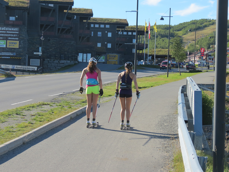
We had agreed between us yesterday whist we had been cycling on the Jotunhiemvegen yesterday that we needed a rest day today. After the noisy campers last night we decided to have a look at the other tent pitch on the site, it was much nicer than the other one much quieter and nice grass. There was just one tent and that was a Dutch guy who was on his own, it was just a shame that we hadn’t looked at this pitch on the site the night before. Anyway we packed up the tent and moved to the new part of the site. As we were on our rest day we took the opportunity to do some clothes washing as the campsite had washing and drying facilities. Later in the afternoon I went up into town to look for some Trolls as I wanted the figures for a little project. As I was cycling up the cycle path to the centre of Beitostølen I had to pass two young lasses on roller skis skiing up the cycle path, now I realised why there was such a good and lengthy cycle path in Beitostølen it obviously doubled up as a x-country loipe for both summer and winter. I soon found a suitable souvenir shop and found some Troll figures that would fit the bill and as I came out of the shop I had a brainwave that I could send them home rather than carry them on the bike. So I popped into the post office which was in the local Spar supermarket to post them home. After that it was a quick bit of caching to find a local TB Hotel before nipping in to the Kiwi supermarket for something for our tea. Are these really rest days?
Beitostølen
Oh poor Frank she seems to be suffering this holiday as she woke to one of her fibro days where she just feels awful like she has flu, so there was no way we were moving on. All she wants to do is sleep so I let her to it and went out on a little caching walk on the hills above the town.
Beitostølen to Vang
map linkIt was a beautiful morning and fortunately Frank was feeling a lot better. The tent didn’t take too long to dry and with everything packed we were off. The gentle incline of the cycle path eased us in but even after our usual 2 mugs of tea for breakfast Frank was still thirsty so we were soon stopping at a bakery cafe in Beitostølen for coffee and a vinabrot which given that I rarely drink coffee was actually quite nice. We hadn’t got far out of Beitostølen when we came across our first cache. I won’t say too much about this cache so as not to give the game away but it was a cunning hide that had us foxed for awhile. Finally we got going again only to stop about 600m further on for another cache. We pulled in at the bend and left the bikes just off the road. Frank found some lovely orchids to photograph whilst I had a look for this cache. I found the little trail to the little bench and the lovely view and started searching. I was soon joined by Frank and we searched and searched all over the place. I was about to call a DNF but Frank said ‘no another 5 minutes’ (she just doesn’t like to be beaten by a cache). It was soon after that that we spotted this brilliantly clever cache.
We noticed that there was another cache only another 600m further on by the same CO and although we had spent a lot of time on these caches we couldn’t resist trying to find this one as well as they were so good. We parked up our bikes at the suggested parking spot and looked for a way to this cache. There was a track but it led to a house. Frank thought she could see a bit of a path through the Birch scrub which turned out to not be a path at all and we ended up hacking up the hill through deep undergrowth and tree brushings. Eventually we got to GZ and the lovely view point and then the fun started. We won’t say any more than to say it was well worth the aggro of the climb up [:D]. But if you are going to tackle this cache it’s best approached via the road up by the new cabins.
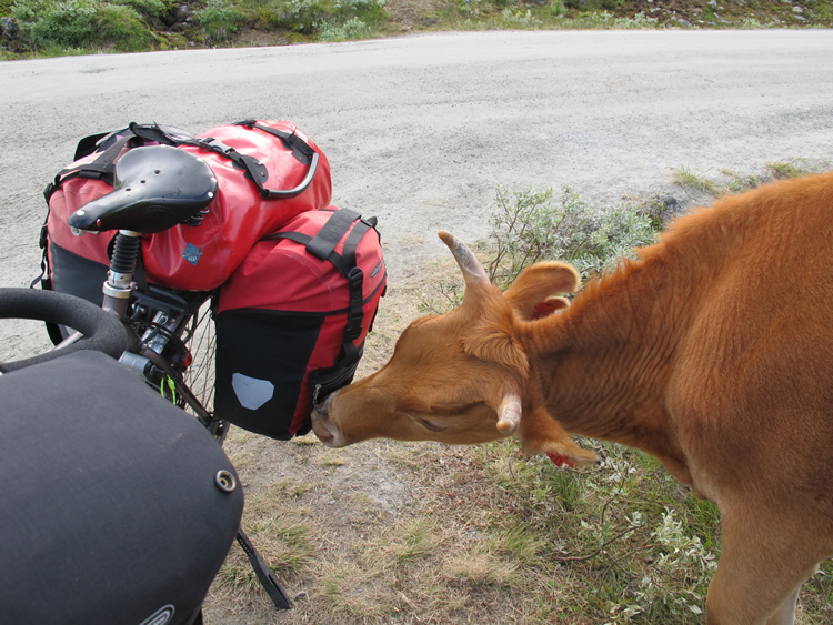
We really had to get going as it was now nearly 2.30pm and we were only a couple of kilometres from Beitostølen. Fortunately there weren’t many more caches on our route. The road went downhill until we got to the 288 where we turned right to head into Rauddalen. At Øyang we stopped at a shop to buy some drinks and whilst Frank was doing that I looked for a cache that was just around the back, fortunately this cache was quite easy to find and we were soon back on our way. It was quite a nice ride through the farms and hay meadows on the side of the Rauddalen valley. At one point when we stopped for a short rest Frank got stung on the back of the leg by what must have been a wasp which was very painful! We soon came to the end of Rauddalen and the tarmac road near the bridge over the river gave way to a the gravel road. This would take us up on to the Slettesfjell. It was getting late in the afternoon so I suggested that we stop and have a brew and something to eat as we hadn’t had anything to eat since the vinabrot at Beitostølen. Hopefully it would give us some energy for the climb and boy did we need it as the gradient increased and we were soon again in the granny gear with our hearts pumping and breathing heavily as we climbed from 750m to 950m. The trees soon gave way to open scrub and although it was hard work we were soon at the dam at the mouth of the Fliensendin lake and the views were tremendous across to the snow capped Jotunheim mountains. This was only part way up and we still had a long way to go to get to the Slettesfjell summit. The next section from the lake had a short steep section initially but then contoured in a diagonal line at an easier gradient to a little flat section where we could see a newly built wooden building and when we got close to it we could see that it was a cafe with tables and benches outside with cows milling around. We pulled into the ‘Mugnetind Kafe’ to have a look. It was just before 6 o’clock and there were only two people there but we seemed to start a trend as within minutes several cars had stopped and the place was heaving with people. The guy said that they were going to shut at 6 0’clock but this was the best crowd they had had all day so they decided to stay open. They were cooking ‘Kvitkako’ on a large hot plate, it is a type of pancake made from barley flour and sour cream which they served with sour cream (which seemed to us to be like yoghurt) and strawberry jam. What was funny were the cows that were milling around they seemed to have a liking for our bikes, they kept head butting the panniers and trying to eat the pannier straps. One of them nearly had my bike over and one took a liking to Frank’s Brooks saddle trying to eat it, we just hoped it wasn’t a relative! I had only just put our coffees down on one of the tables when one of the cows bumped the table and spilt our coffees! Frank got talking to a couple from Oslo who turned out to be both teachers and the woman also worked in special education and she had relatives who lived near Cambridge, it’s a small world!
Suitably refuelled with the pancakes and coffee we just couldn’t put off the final climb up to Slettesfjellet any more so we said our goodbyes to the couple from Oslo and headed up the gravel road. Initially it was of a reasonable gradient with a little flat section in the middle but as we got closer to the summit it kicked up a bit in gradient and there were a couple of points where Frank had to get off and push. As we looked back there were tremendous views looking across to the snow capped Jotunheim mountains. Eventually we made it to the summit and the views were amazing as the skies to West were just black threatening clouds which looked angry and we thought surely they must contain rain, we had been looking at the weather forecast and it reckoned on rain for the night and the next day. We decided to put on our fleeces and a waterproof on for the next downhill section as it was getting a little chilly. And boy was it a good downhill, even though we had our Magura hydraulic brakes we still had to stop half way down to give our hands a rest and cool the rims down a bit although with it being a gravel road you just couldn’t let the bike run as the surface was just a bit too loose in places. We soon met the 293 and carried on down the 289. We had intended to take the 302 down to the E16 but we were so enjoying the downhill that was on good tarmac that we must have missed the turning. When we got to the E16 just over the bridge and turned right I did wonder if we were correct as we came to a tunnel where Ala camping was supposed to be. I checked the GPS and realised what we had done. Frank was a little tired by now and wasn’t that happy to be going on any further but I persuaded her that it was better to go on to Vang camping rather than go back to Ala camping as it would be less distance to do the next day. Fortunately there was little traffic on the E16 and as it was getting dusk we put our lights on. We got to Vang camping at about 8:30pm, as we pulled into the campsite a young lady came out of the main reception building to greet us. Are you looking to camp or would you like a hut? Well as it was very late and as we were both fairly knackered and it looked like rain we went for the hut without question.
Vang
The forecast wasn’t good so we decided on a rest day as climbing up the Slettesfjell yesterday had really knackered us. It didn’t help but Frank found the bed although a ‘put you up’ really comfortable. The threatening skies of yesterday evening only gave rise to overcast skies and the rain never materialised. So I rode up to the main part of the village to see if the Co-op was open but as we suspected it was closed as it Sunday. We ended up having a burger and chips from the garage across the road from the campsite.
Vang to Søre Syndin
map linkIt was a beautiful sunny morning and as we were well rested we were raring to go. There is one good thing about staying in a hut and that is that it doesn’t take so long to pack up. Fortunately for once it wasn’t straight up from the campsite and we had the 4kms along the cycle path to warm up before we turned off the E16. Unfortunately it was a little steep to start with but fortunately after climbing 80m in height there was a turnoff to the left and right track eased in gradient to a series of zigzag sections through the meadows. There were lovely views through the trees looking down the valley and it was hard work on the legs so we did it in short bursts the steepest part was between 700m and 850m where we stopped just after a gate across the track for some lunch. The section after that was was through trees and birch scrub which wasn’t quite so steep but at 950m there were a lot of false summits. Eventually we hit the highest point and there was open moorland with small snow capped mountains behind. From the highest point we dropped down to the Nødre Syndin lake where we had to cross the river that flowed out of it. Our friend Stan had mentioned this to us when we had a Skype call just before we left the UK. We stopped and popped on our Teva sandals and I checked it out. The crossing was only really ankle deep and didn’t come up to the height of the bottom brackets so we waded across with the panniers still on the bikes. It wasn’t quite like some of the river crossing that we have had to do in Iceland, the water was certainly much warmer. Once we had dried our feet and got our cycling boots back on we found a nice spot on some smooth rocks by the side of the lake where we stopped and had a lovely cup of tea and a snack, it was an absolutely beautiful spot.
The next bit of the track was a bit tricky and we had been warned by Stan and the guy from Vang campsite that this part wasn’t easy to cycle. The track was narrow and rocky with some parts muddy and rutted. Certain parts you could ride OK with care but on certain parts it was easier to get off and push the bikes. At one point there were deep ruts made by tractors and Frank tried to ride through them but got her pedals caught in the ground either side. Fortunately the track didn’t go on for too long and we were soon back on a gravel road and in amongst the summer houses. Our route climbed a little above the lake and then down to cross the little river that joined Nødre Syndin with the Søre Syndin lake. It was there that we met two women cyclists they must have been cycling hard as they were just wearing cropped tops and we were wearing windproofs. We stopped off near a dried-up river bed to find a cache and continued on to the side of the Søre Syndin lake where we started to look for a water source and a place to camp. Just by the side of the road we spotted a pipe with water rushing from it. It looked clear and free flowing so we judged it was a supply from a spring, but we always boil our water just to be on the safe side. Soon after finding the water we soon spotted a good little camping spot just off the road above the lake. We managed to get the bikes down off the road and with a little jiggling managed to get our tent pitched for a comfortable night’s sleep amongst the rocks and heather on a little grassy bit. With the tent up Frank started inflating the Expeds and I got the stove on for a well earned brew. Whilst we were cooking our evening meal we were treated to a lovely sunset. It had been a tiring but lovely days cycling.
Søre Syndin to Oset
map linkIt was a beautiful morning and there was a lovely mist on the lake with hardly a breath of wind. We were expecting to be plagued by mosquitos but there were hardly any about. As I prepared breakfast it was obvious that we were at an altitude as the unopened packet of Honey Smacks looked like it had been vacuum packed. It didn’t take long to pack everything up and we were soon back in the saddle. It was nice to ride down the Johmsvegen from our campsite for a change as it is usually uphill! Whilst we had been planning this trip I had downloaded a gpx file for the phone and GPS’s showing the route of the Mjølkevegen. I had noticed that at a point just about half a mile down the road from our camping spot the gpx route showed that the Mjølkevegen route went straight up the steep mountain side. We thought it must be wrong but you can never be sure. We were glad to find when we got there that the route was indeed wrong and it went the way that I predicted it would where we would turn off left from the gravel road onto a track. The track turned out to be a narrow track which was very rocky and muddy in places, it obviously wasn’t used by many vehicles. It took us for about a mile through some birch scrub and then through some open moorland. With care we could ride most of it but there were parts where it was safer to get off and push. We were soon at the little farmstead at Trønastølen where we joined the Jaglangvegen which was a wide gravel road. A little way on we reached the junction at Solvollstølen where we took the Muckelivegen which took us further down the valley towards Våsetvatnet.
It was a lovely sunny morning and most of the route was downhill which made a welcome change although there was a little climb up Raundokkstølen having crossed over the Rassvæta river. We were soon down by the side of the Våsetvatnet and it was easy going on the flat. When we reached the main road at Våset we decided to try and find something for lunch. We had a decision to go left or right and I had a hunch that we might find something going left even though it wasn’t on our way. Fortunately I was proved right as we found the Sekskanten diner about 300m down on the left. The place was empty but there was a lady in the kitchen who came through to meet us. I asked her if she could do us something for lunch. She said she could do us bacon and eggs with fried potatoes for lunch. We seemed to start a trend as several people came in to eat after us. Suitably fed and watered we set off again. The first part up the Panoramavegen wasn’t too bad but when we turned off the main road on to the Valtjednvegen it was a SOD of a climb out of Våset. We were back to our usual routine, we would cycle as far as we could up the hill and then rest before tackling the next bit. It was a wide gravel road through some rather uninteresting birch scrub with few wild flowers or a good view to distract us. Eventually we got to the top at and we were glad to find the Gomobu Fjellstove where we stopped for some waffles and coffee, which were most welcome. The route on from there was fairly flat which was a relief and we crossed open moorland with several small lakes and bog passing the Graneistjernet lake. We stopped at the Valtjern kiosk which wasn’t open so we nipped down the little lane to its right to find a cache which was only a few 100m away.
From there we skirted around the bottom of the Valtjernknatten 1060m through Valtjednstølen with a good view over the Valtjernet.at Brattåsen we had a choice of routes as the Mjølkevegen was signposted in two directions they both ended up at the same place at Furuset. We decided to go via the road that went past the Gauklitjernet lake as there was a cache that we could find en route. It was a lovely evening and there were some wonderful clouds in the sky. When we got near to the cache we realised that we would have to leave the bikes by the side of the road and head across the moor to find the cache. It was a bit of a trek as the heather was deep in places and there were some boggy parts that we had to skirt around. It was worth the trek as the cache was next to a stone marker that was similar to the Ordnance Survey triangulation pillars we have in the UK it was a marker for Baseline Tisleia East survey. Having successfully found the cache we headed back to the bikes and carried gently downhill to Gaukelii where we then skirted around the Gaukelitjednet lake and then climbed up through the forest and then down to Furuset. At the junction there was a wee little cache that didn’t take too long to find. It was starting to get late so we decided that we had better find a place to camp. My friend Stan had said that there were probably some places to camp near the Tisleifjorden lake so headed there. When we got there the Tisleifjorden is used as a reservoir as there is a large dam at the southern end which we crossed over rather than drop down on the road and have to climb up the other side, it gave us a good view of the lake. On reaching the other side at Øset we looked for a place to camp. I spotted a small path running towards the lake and found a nice little lichen spot in amongst the heather and bilberry. Whilst Frank started getting the tent up I went off to get some water, fortunately there was stream down at the end of the path not very far away.

Oset to Gol
map linkWoke up to another beautiful morning which was good as we really needed to get the tent nice and dry as we would be staying with our friends Stan & Daema in Gol. While we were having breakfast a woodpecker appeared and hammered on the nearby telegraph pole, unfortunately it was just on the wrong side of the pole to get a good photo. We stretched the tent out on the heather and made sure that it was crispy and dry before packing it away. Just up the road from our camping spot was the lovely Stave church at Oset. We stopped to have a look at it, sadly it was closed as we still haven’t been able to see inside one of these Norwegian stave churches. From there we climbed up to Ørterstølen where we stopped at the Fjellstove to have some lunch. The owners didn’t speak English and seemed east European in origin. When I asked the lady to explain what one of the things was on the menu, she put her hands above her head indicating antlers so we guessed it was reindeer so we decided to have that and it was indeed a lovely reindeer stew with carrots and rice.
Fortunately that was most of the climbing completed and the gravel road took us through farmland with grazing cattle and then into forest before bringing us out on to the 51 which was the main road down into Gol. We briefly stopped at the junction to pick up a cache before heading off for Gol our destination for the day. It seemed quite strange being back on tarmac after all the gravel roads that we had been on the Mjølkevegen. It was a good ride down to Gol apart from the odd idiot that couldn’t wait to overtake us just before a bend and only just missed the car coming around the corner. Before we knew it we were in Gol where we stopped to buy Stan & Damae some flowers and a bottle of wine. Well that wasn’t easy as I asked the guy in the flower shop. Oh he said you can only buy wine at the government licenced store in town. It is ridiculous he said I bet you don’t see english people rolling around in the street drunk all day. Having finally bought the wine we headed off to find Stan & Damae’s house. It was so nice to finally meet up with Stan & Damae, we have been conversing via e-mail for several years after Stan e-mailed me concerning a question about the Rallarvegen.

Gol
We spent most of the morning chatting to Stan about all sorts of things mainly about cycle touring and later we had go on his and Damae’s Rolhof equipped touring bikes which was great as we had always wanted to try Rolhof gears. In the afternoon Frank and I explored the area around Gol where we did a few of its caches and the road up to Gol Kirke. When we got back Stan had to pick up a parcel from the Post Office so we went down in his Citroën Dyane. Well my first ever car was a Dyane and when I found out that Stan had one he promised me a ride in it. Well it was brilliant we put the roof down and set off. Well the noise of the engine and the jaunty road holding brought it all back, it was just like being 22 again. Why on earth did I ever sell that car, I wished I still had it.

Gol to Nesbyen
map linkWe said our goodbyes to Stan, Daema and little Odd Egill and headed off to find the railway station. Stan had suggested that we take a track that started at the station and ran alongside the railway as it was a better way to get to Nesbyen rather than hacking down the fv7 with all its traffic and lorries. It was a gravel track that obviously served the local farms on that side of the valley and the only traffic we came across was the postman in his van. About halfway along it was obviously little used as it became a dual carriageway track but it was a lovely route where we feasted on wild raspberries and strawberries that lined the track. When we got to the fv7 we had a short few hundred metres on the fv7 before we turned onto the Rudvegen 216 to take us to Nesbyen. Just as we left the junction Frank spotted a grass snake on the road sadly it had been hit by a car. The Rudvegen was a fairly quiet road that followed along the route of the railway and I had a fright as I was just coming around a bend when there was a loud hoot from the train that I hadn’t realised was just below me!
At Nesbyen station we stopped to find a cache before heading into town to find some lunch. We soon found a Remi store which also had a cafe so we stopped there for lunch. It was then that Frank’s stomach cramps problem reoccurred. She had problems since we had at been at Vang and thought she had got over it. Fortunately there was a Boots the chemist in Nesbyen so we stopped there to see if they could suggest something for it. There was no way that Frank was going to make it up the Rukkeddallen that day as it was a fair bit of climbing so I suggested that we stop at the campsite at Nesbyen and that we stop in a hytte if it was possible as it would be much more comfortable for Frank rather than have to scramble in and out of a tent. Poor lass she seems to have had it bad this tour what with her back. When we got to the campsite there was a number to ring on the reception door. When I rang the number luckily the lady had a cabin for two available. It was quite a nice cabin as it had obviously been a hut that had previously been attached to a caravan on the site. It was quite comfortable with a large covered veranda, a double bed, sofa, easy chair and a small kitchen with a fridge and a two ring cooker.

Nesbyen
Frank’s stomach cramps still weren’t a hundred percent better in the morning although they weren’t as bad as the day before, at least the medication that the chemist had suggested seemed to be helping. There was still no way she could comfortably ride so I suggested we had better stop another night to give the medication time to do its job. While Frank sat reading I had a cycle around Nesbyen and did a couple of the caches in the afternoon.

Nesbyen to Rødberg
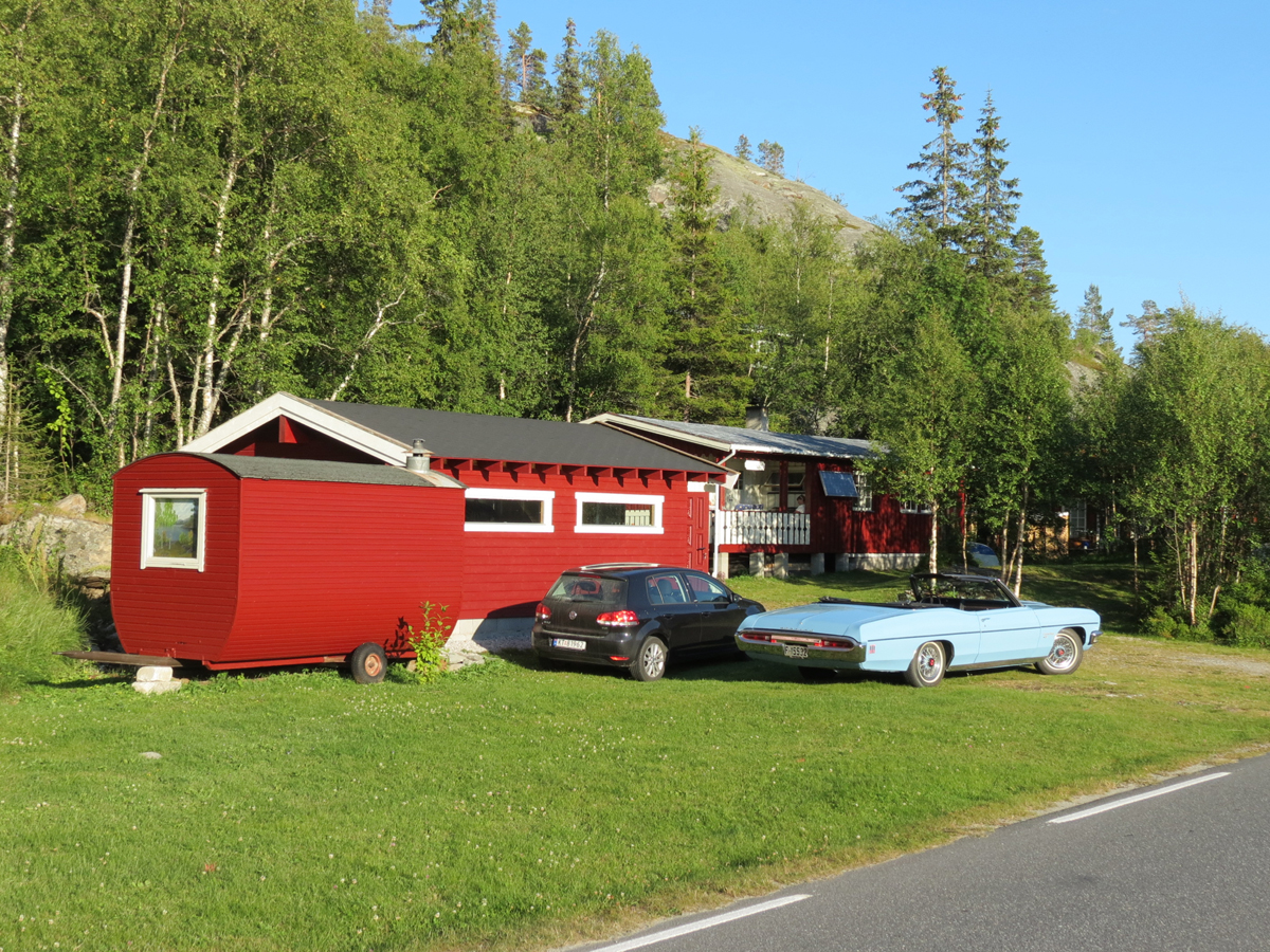
It was a lovely morning again as we left the hut just before 11.00 not the earliest of starts but we weren’t sure how Frank was going to be, she reckoned that she was a lot better. We nipped into the Kiwi to buy something for our tea as we weren’t sure if we would get to Rødberg that night or find a shop open as it was Sunday. It was a bit of a pull out of Nesbyen up some hairpin bends, but we were both pleased with ourselves as we both got up it in second gear, either we were getting fitter or the gradient wasn’t as steep as we thought. Fortunately after the initial steepness of the hairpins it was less of a gradient for a while as we steadily climbed up through trees and hay meadows which almost had an alpine feel to it and as ever we had the burbling river running alongside the road most of the time. It was a beautiful day with hardly a cloud in the sky which meant it was quite hot in the sun and we had to keep looking for a shady spot to stop for a drink. There must have been a classic car rally on somewhere as although there wasn’t too much traffic on the road we kept being passed by old classic cars a lot of them were old American cars such Dodge Chargers, Corvettes and old Chevrolets. When it was getting towards 2.00pm I suggested to Frank that we look out for somewhere to have some lunch, preferably in the shade. I saw her stop up ahead of me and she had spotted a nice log cabin style bus stop which was just perfect.
It was quite along way up Rukkedalen and we seemed to be climbing for ages and with the heat it was a little exhausting. Eventually at 825m the road started to flatten out and we caught sight of the Synstevatn which feeds the Rukkedøla river which we had been following all the way up the Rukkedalen. The road took us out of the main forest into birch scrub as we got to the Buvatn, but on leaving the lake side we were back into deep forest as we climbed the last climb up to the junction with the 120. We knew that was most of the climbing done and that it would be downhill to Rødberg. It was a lovely evening as we cycled along the Tunhovdfjorden which is the main reservoir for the hydro plant at Rødberg. We were soon cycling across the dam at the southern end of the Tunhovdfjorden and with only a little climb up from the dam we were soon on the descent into Rodberg. It was a cracking descent down numerous hairpins until we were soon alongside the hydro plant arriving in Rødberg just after 7.30pm. After a quick visit to the Kiwi store we headed off to find the campsite. We had decided to hire a hytte if we could as it was late. There is only one problem with Rødberg and that is the noise of hydro plant, it is fairly loud and we were the other side of the lake. Fortunately we were both so tired after our cycle that we were both sound asleep as our heads hit the pillow.
Rødberg to Holman Camping
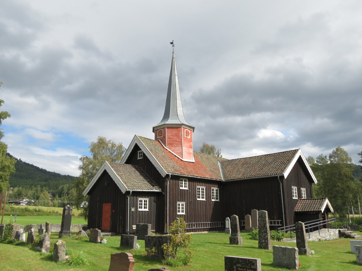
map linkWe were quite glad that we were in the hut as it meant that we could get away earlier. It was a lovely morning as we headed off down the FV40. Initially there was a cycle path for a few miles out of Rødberg but it soon petered out and we were back on the road. The traffic was quite light so it didn’t matter and it was quite a change cycling on the flat. We were soon passing the lovely Skjønne Kyrkje with its white painted sides and its slate grey roof, it looked rather stunning in the sunlight. The road from there follows the the side of the Norefjorden and at its southern end we went through the Rustandtunnelen which is a very short tunnel and I stopped to take a photo for our tunnel map. We turned off the FV40 and on to the Fv116 at Nore to follow the Numedalsruta. At Nore we stopped to look at the church and we rather liked their glass recycling hut which was very nicely disguise as a small barn. It little way on we came to the Nore stavkyrkje. It was in the process of being renovated with a new roof. I spoke to one of the roofers and he said they had been working on it for 2 months. As we were about to depart a chap came along and pronounced that he had the key and would give us a guided tour of the inside. We were so lucky he came along as we have always wanted to have a look inside one of these Stave churches, it was fascinating inside and half reminded me of the inside of some of the Buddhist temples that we had seen in Ladakh being dark and wooden with big post beams.
From there we followed the western shore of the Kravikfjorden through forest with hay meadows on every flat piece of ground. There were some lovely barns and old buildings at Nordre Frygene. A little further on were the burial mounds at the Frygne Gravfelt. There was also a lovely old barn at Nordre Kittilsland. When we got to the end of Kravikfjorden we found a lovely little place at the edge of the lake for a brew stop and while we there we were entertained by a pied Wagtail that flited around the rocks on the lake shore.After crossing the bridge over the Kravikfjorden at Kravikfjord we were only back on the Fv40 for a short time when we turned off at the end of the Kravikfjorden and took the Fv109. All the way along the valley is the Numedal line which is mainly disused and we crossed it at the small halt at Fossebrekke. It was a scenic route however it unfortunately involved a few hills which was a bit tiring. It was starting to cloud over and by the time we got to Mykstu it had started to spit with rain and as we got to Veggli it really did start to rain so we sheltered in the porch of the Veggli kirke to put on our full waterproofs. It was a short run down to the center of Veggli where we soon found a Rimi supermarket where we could stock up on food. While we were paying I asked the assistant if the Holman camping site was still there and she said it was and it wasn’t too far down the road which was a relief as we were both getting tired and didn’t really fancy adding to our miles that day. Although it was coming down in stair rods we were both well kitted out and grateful to see the sign to Holman camping. Fortunately the chap at the campsite had a hut available which was great, we decided to pay extra for one with its own shower and toilet which was much better than having to trek down to the showers in this downpour.

Holman Camping
I woke early to the sound of rain, it was what we had expected but this was rain that was coming down in stair rods. As I lay listening to it I checked the forecast on my phone and it forecast for the rain to stop overnight and for it to be better the next day. As we had a day in hand we could afford to stay another day and ride down to Kongsberg tomorrow as long as the campsite owner said we could stay another day. We had some breakfast and I gave him a ring. He laughed when I asked him if we could stay another day and said he didn’t blame us with the weather he would have done the same in the circumstances. Well it did rain and it rained solidly all day. We sat in the hytte looking out at the river below as it rose gradually covering more and more of the rocks until it was in full spate having risen a good metre in height. It was quite peaceful sitting on the veranda listening to the new celtic folk rock group Mànran that I had just discovered by accident while searching for something else on the BBC iplayer app.

Holman camping to Oslo
map linkFortunately the rain had stopped and the river was still very high. We packed our panniers up and tidied up the cabin. As we left the campsite it was a little overcast but there were breaks in the clouds with the sun breaking through. From the Idrettsskolen Numedal folkehøgskole there was a cyclepath which was nice however after about a mile it unfortunately stopped. A stream in spate by the side of the Fv40.
It was a nice ride down the 40 and it was quite a change cycling on the flat through fields of crops either side of the road especially as there didn’t seem to be much traffic. We stopped at the Numedal Kro restaurant for a mid morning coffee and waffles which helped us along the way. At Djupdal the Numedalsruta was signposted to go along the Fv98 however looking at the the terrain that it covered it looked very much like the route the day before and much hillier than the main road and as there seemed to be little traffic on the Fv40 we decided to stick with the main road, it also meant we could pick up a few caches along the route. Just before Flesberg we saw a train on the Numedal line with wagons of concrete sleepers apparently the line between Kongsberg and Flesberg is being used to move timber. After a derailment in to 2014 the old timber sleepers are being replaced with concrete ones. We stopped at Flesberg as there was a lovely Stave church which had an interesting wall around it made from slabs of stone many of them had steel rings attached to them which were used by the local farmers to tie up your horse when they attended the church service. The rings had marks on them but we couldn’t work out if they were just decoration or markings to depict whose ring it was.
From Flesberg the road runs very close to the Flemsdal line through forest and we stopped several times to find several caches. It was easy cycling as we were obvious following the flowing river Lågen down to Kongsberg. At Svene we crossed to the other side of the valley and it wasn’t long before we were at the outskirts of Kongsberg and we found good cyclepaths and a cyclepath that went across the Lågen river attached to the side of a railway bridge. We soon found the railway station just as it started to rain. We had looked at the forecast which was rain for the next few days and as there was no campsite in Kongsberg we might as well get ourselves to Gardermoen a day early and make a day trip into Oslo. Unfortunately they didn’t have an available room at the Raddison Park hotel but we did manage to get one in the Raddison Blu hotel which is only a few hundred meters away!
Oslo
It rained most of the morning and we decide not to bother going in to Oslo as we had had several days there back in 2002. We didn’t check out from the hotel until just before 12.00 and we wandered the bikes across to the Raddison Park hotel. As there was a queue of people waiting to book out we put the bikes under a covered way next to the hotel entrance and had a brew to use up the remaining gas. Once we had checked into the hotel Frank decided to to sit and read her Kindle while I nipped out and found a few of the caches near the airport.
Oslo to Home
Our flight to Amsterdam was on a Embraer 190 and was fairly uneventful, fortunately the weather was good so we got some good views of Friesian Islands and Holland as we landed at Schiphol. We had a bit more time before our connecting flight than we had had on the way out so we had time to get a quick drink. The flight to Norwich was again on a Fokker 70 and the good weather stayed with us which again gave us good views. Our flight path took us just to the north of Great Yarmouth so we had good views of the the town and Breydon water, Filby broad and Acle bridge. After we had landed we headed into the baggage reclaim area. Only one of our flight bags appeared and then a baggage handler chappy arrived carrying our bikes one in one hand one in the other, I was well impressed as they weight 16kg each. I asked him if all the bags were now unloaded from that flight as we were missing one. He said it was all unloaded so we had better report it was missing, which we duly did. They said it would probably arrive on the next flight which wouldn’t be until the morning but they would send it on to us by courier. The unfortunate thing was that the missing bag had all the tools in it to put the bikes back together. So riding them back to my sister’s wasn’t going to be an option. Our only solution was to ring for a taxi and hope they had a minibus that could take us and the bikes to my sister’s where our car was parked. A quick phone call to a local taxi firm that we knew and it was all sorted. As we waited for the taxi we did a quick total up of the things that were in the missing bag, tent, panniers, stove, waterproofs it soon mounted up, at least if it had been lost we had it all insured. Fortunately for us it arrived at our house two days later by courier.


